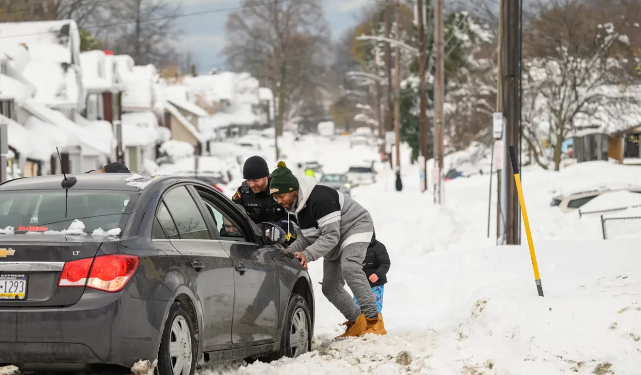
La Casa De Pizza was open for business Tuesday, but the outdoor seating at the cozy little restaurant on Main Street in North East, Pennsylvania, probably won’t be needed.
The National Weather Service says the borough of 4,100 people has been slammed with more than 55 inches of snow since a lake-effect storm began pounding the region on Thanksgiving Day. More is likely on the way − cities and towns surrounding the Great Lakes were bracing for another round of the powerful, lake-effect snowstorms that have hammered parts of the Upper Midwest and Northeast for almost a week with up to 5 feet of snow.
Still, the pizza restaurant, nearby coin shop and North East Borough building are open in the town near Lake Erie’s shores. Workers have been grinding around the clock to clear the roads.
“It’s business as usual, what can you do?” Borough Manager Patrick Gehrlein told USA TODAY. “We prepare for it. People are plowing out ahead of the next storm.”
Big storms are nothing new in North East. Gehrlein, who is 51 and has lived his entire life in the area, recalled Christmas Day 2017, when he said the borough was blasted by 5 feet of snow in one day. The current storm, however, is lingering, and Norte East is bracing for 16 more inches by Friday.
The coming snow is expected to be wet and heavy. With high winds also in the forecast, periods of almost zero visibility are likely, Gehrlein said. And when it finally melts, flooding becomes a major concern, he said.
“We’ve have bad storms, but this is starting to eclipse all of them,” Gehrlein said. “This is a lot for a little town.”
Storm could bring more ‘treacherous’ travel conditions
A storm sweeping across southern Canada will unleash strong winds, snow showers and more lake-effect snow from Tuesday night through Thursday across portions of the Midwest and Northeast, AccuWeather said. The frigid flow of air over the relatively warm waters of the Great Lakes will fuel the additional bands of snow and “treacherous travel conditions across the region,” AccuWeather warned.
The National Weather Service forecast called for heavy snow for the Upper Peninsula of Michigan and the northern Lower Peninsula late Tuesday and Wednesday. Moderate to heavy snow was also forecast for parts of Northern New England.
Clipper system to go against type, bring more heavy snow
The National Weather Service refers to the new storm headed toward the Upper Midwest and Great Lakes as a “potent Clipper system.”
That type of low-pressure system, typically originating in Canada and often called an “Alberta Clipper,” is characterized by moving quickly and producing light snow, strong winds and chilly temperatures, the NWS said.
In this instance, the snowfall may actually be considerable at times, on the heels of the abundant lake-effect snow of recent days. “Over the lake-effect snow belts, 1-2 feet of snowfall can be expected, with heavy snow also possible across New England as the Clipper deepens to the north,” the weather service said.
Not clear which towns will be hit by next storm
Several cities and towns in New York state on or near Lake Ontario had reported 5 feet of snow or more as of Tuesday morning. In Pennsylvania, snow-accustomed Erie set a single-day record on Friday when 22 inches of snow fell. Parts of Erie County, including North East Borough, have been hit with more than 4 feet.
Slight alterations in wind and other factors will determine where the heaviest snow will fall, AccuWeather senior meteorologist Tom Kines said.
“These lake-effect bands can be pretty skinny, maybe affect a 10-mile area,” Kines told USA TODAY. “There is no guarantee the same area gets hit again this week.”
Freezing temperatures head south
Temperatures will remain far below seasonal for a much wider area than where the heavy snow is falling, the National Weather Service said − 10 to 15 degrees below average over parts of the Ohio Valley, the Mid-Atlantic and the Southeast.
Temperatures on Thursday night could drop well below freezing across the South. Atlanta’s temperature is forecast to drop to 23 degrees; Charlotte, North Carolina, will be down to 22 degrees.
Snow will spread over wide area
The latest storm will be farther reaching than what has swept across the region in the last week, AccuWeather notes. That snow was primarily confined to areas closer to the Great Lakes. This time, snow showers and intense snow squalls can extend hundreds of miles away from the lakes, including highways near major cities. The squalls could prompt a sudden drop in visibility and quickly cover roads with a thin coating of ice and snow, presenting a danger to travelers, AccuWeather warned.
The impact could reach parts of Wisconsin, Ohio, West Virginia, New York, New Jersey, Pennsylvania, Maryland, northwestern Virginia, northern, northwestern and central New Jersey and much of New England. Milwaukee, Chicago, Detroit, Indianapolis and Columbus, Ohio, all could be affected by the snow and ice, AccuWeather said.
What is lake-effect snow?
Lake-effect snow, which can last from a few minutes to several days, develops from narrow bands of clouds that form when cold, dry arctic air passes over a large, relatively mild lake. As the cold air passes over the unfrozen and “warm” waters of the Great Lakes, warmth and moisture are transferred into the lowest portion of the atmosphere, the National Weather Service says. The air rises and clouds form and grow into narrow bands that produce 2 to 3 inches of snow an hour or more.
Wind direction is also a key component in determining which areas will receive lake-effect snow. Heavy snow may be falling in one spot, while the sun may be shining just a mile or two away in either direction.
